Grong
(Kråangke) is a municipality in Trøndelag county, Norway. It is part of the Namdalen region. The administrative centre of the municipality is the village of Medjå (sometimes called Grong also). Other villages in the municipality include Bergsmoen, Formofoss, Gartland, and Harran.
The 1136 km2 municipality is the 96th largest by area out of the 356 municipalities in Norway. Grong is the 263rd most populous municipality in Norway with a population of 2,287. The municipality's population density is 2.1 PD/km2 and its population has decreased by 5.1% over the previous 10-year period.
Grong was established as a municipality on 1 January 1838 (see formannskapsdistrikt law). On 1 January 1901, the northwestern district of Grong (population: 1,046) was separated to form the new municipality of Høylandet. On 1 January 1923, the large municipality of Grong was divided into four smaller municipalities: Grong (population: 1,272) in the southwest, Harran (population: 630) in the centre, Røyrvik (population: 392) in the northeast, and Namsskogan (population: 469) in the northwest.
During the 1960s, there were many municipal mergers across Norway due to the work of the Schei Committee. On 1 January 1964, the neighboring municipalities of Harran (population: 1,085) and Grong (population: 1,962) were merged (back together) to form a new municipality called Grong.
On 1 January 2018, the municipality switched from the old Nord-Trøndelag county to the new Trøndelag county.
Map - Grong
Map


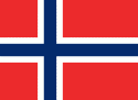
Country - Norway
 |
 |
| Flag of Norway | |
Norway has a total area of 385,207 km2 and had a population of 5,425,270 in January 2022. The country shares a long eastern border with Sweden at a length of 1,619 km. It is bordered by Finland and Russia to the northeast and the Skagerrak strait to the south, on the other side of which are Denmark and the United Kingdom. Norway has an extensive coastline, facing the North Atlantic Ocean and the Barents Sea. The maritime influence dominates Norway's climate, with mild lowland temperatures on the sea coasts; the interior, while colder, is also significantly milder than areas elsewhere in the world on such northerly latitudes. Even during polar night in the north, temperatures above freezing are commonplace on the coastline. The maritime influence brings high rainfall and snowfall to some areas of the country.
Currency / Language
| ISO | Currency | Symbol | Significant figures |
|---|---|---|---|
| NOK | Norwegian krone | kr | 2 |
| ISO | Language |
|---|---|
| FI | Finnish language |
| SE | Northern Sami |
| NO | Norwegian language |
| NN | Nynorsk |